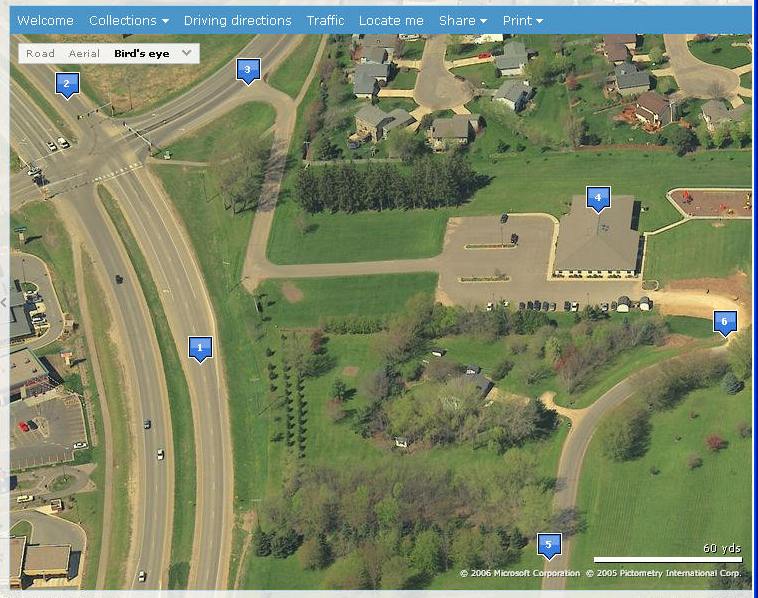
This map shows you how to locate Community Presbyterian Church. For an interactive map including a printable road map click on Interactive Aerial View.
1. This is 55th Street. You can exit on 55th Street from highway 52 going
North or South.
Sam's club is just to the left (south) of this label.
2. This is county road 22. Also known as Circle Drive. Turn right
onto 55th Street at the
intersection.
3. This is the main entrance. Turn right from 55th Street.
4. This is CPC !
5. This is Villa Road. You can get to Villa Road by turning right off
of 55th Street
at the Sam's Club/Wall Mart entrance. This intersection is
just off the lower
left of this map.
6. This is our back entrance. It is paved now. The photo is a little down level.